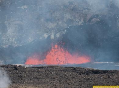
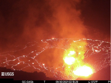
It was one year ago today that Kilauea Volcano started a new eruption at Halema’uma’u Crater. To be exact, this eruption began at 3:21 p.m. on September 29, 2021. Observing…
Kilauea Volcano has been the most active volcano in Hawaii in recent decades. Kilauea has changed where it erupts and how vigorously it erupts many, many times. Mostly, the evidence…
* Hawaii Volcanoes National Park offers an option to purchase a digital entry ticket that is designed to save a little time. Tickets can be purchased through this link at…
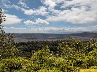
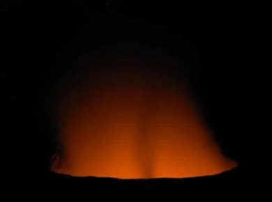
Mahalo to Joyce Bowers and Gene King for sharing this super neat volcano photo for Aloha Friday Photos. Joyce and Gene captured this shot near Halema’uma’u Crater within Hawaii Volcanoes…
– Kilauea Volcano on Hawaii (Big) Island started erupting again yesterday after a pause since May. This current eruption is at Halemaumau Crater inside of Hawaii Volcanoes National Park. You…
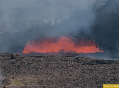
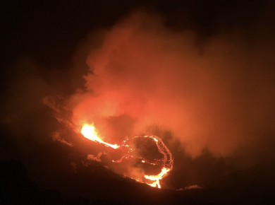
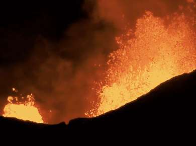
Kilauea Volcano erupted at about 9:30pm Hawaii Time on Sunday, December 20th! The eruption occurred at Halema’uma’u Crater at the Kilauea summit inside Hawaii Volcanoes National Park. For more than…
* The strike that affected service at the Royal Hawaiian, Sheraton Waikiki, Westin Moana Surfrider, Sheraton Princess Kaiulani and Sheraton Maui is over. * The cascading pools of Oheo in…
* Hotel workers at five Hawaii hotels are on strike. We had hoped this strike would be short-lived as many in the past have been, however this one is now…
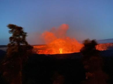
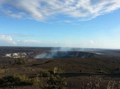
Mahalo to Diana Tan of Canberra, Australia for sharing this interesting Aloha Friday Photo with us. Diana took this photo of the smoking Halemaumau crater while visiting Hawaii Volcanoes National…
– We’re happy to report that Hawaii Volcanoes National Park plans to reopen! After experiencing hundreds of earthquakes and other risks, the area around Hawaii Volcanoes National Park has settled…
Your news and social media timelines might be flooded with images of the vigorous volcanic eruptions in Hawaii. These jaw-dropping scenes with fountains and rivers of lava are absolutely amazing.…
We are frequently asked about when is the best time to see lava in Hawaii. There are multiple answers a question like that, which appears to be a simple question…